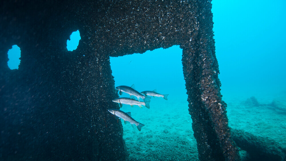
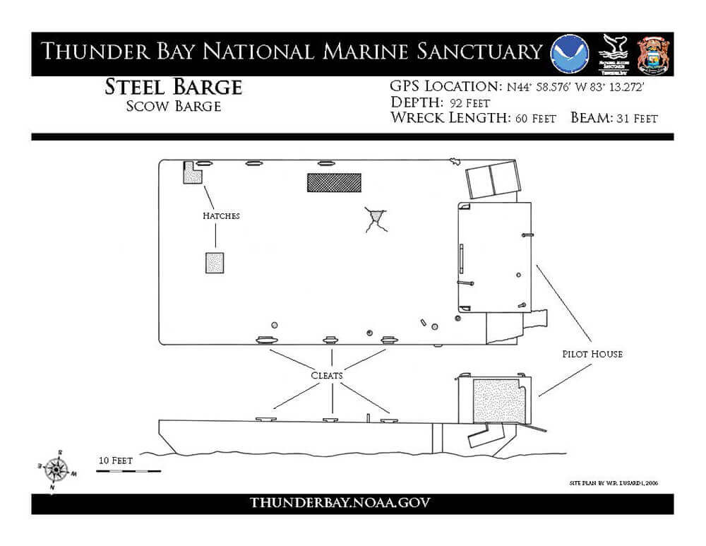
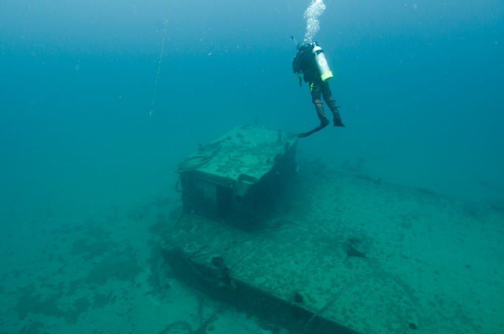
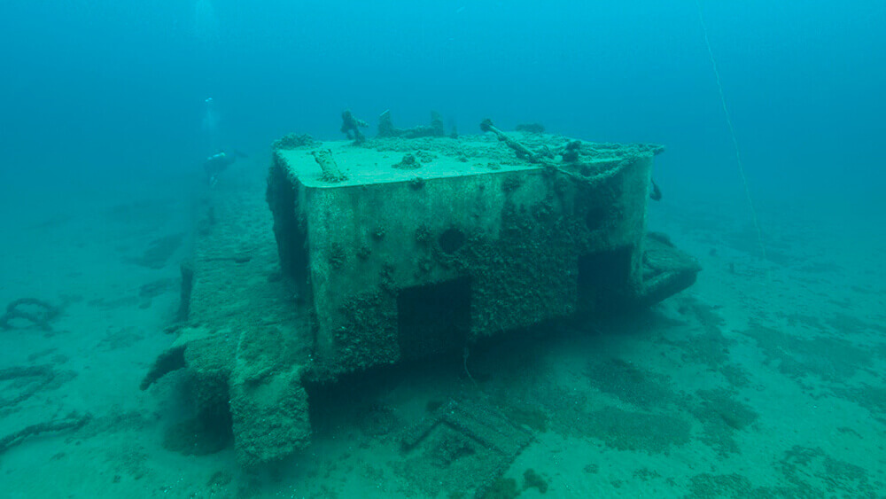
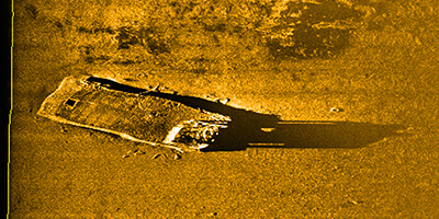
Steel Barge

a steel shipwreck
A diver hovers in the distance behind the pilot house of the Steel Barge shipwreck
a sonar scan of a boxy looking shipwreck
Sonar image of the Steel Barge shipwreck.

Vessel Type: Barge

GPS Location: N44°58.576’ W83°13.272’

Depth: 92 feet

Wreck Length: 60 feet

Beam: 30 feet

Mooring Buoy Data

Description: This steel deck barge of unknown origins appears to date to the middle 20th century and likely foundered as there is no fire or collision damage. The barge rests upright on the lake bottom in nearly 100 feet of water. A pilothouse is located at the stern and cables and debris are scattered about the wreck site.

4 fish swim in front of a doorway of a shipwreck
Fish find a hiding place in the Steel Barge shipwreck.
a a diagram of the steel barge
Site plan of the Steel Barge shipwreck.
A diver examining the wreck of Steel Barge ship
A diver hovers over the Steel Barge shipwreck.